The diverse ecosystem of Alaska’s Yukon-Kuskokwim Delta
- Maps
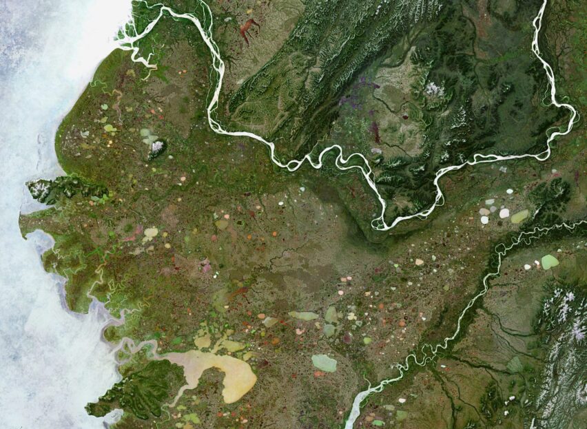
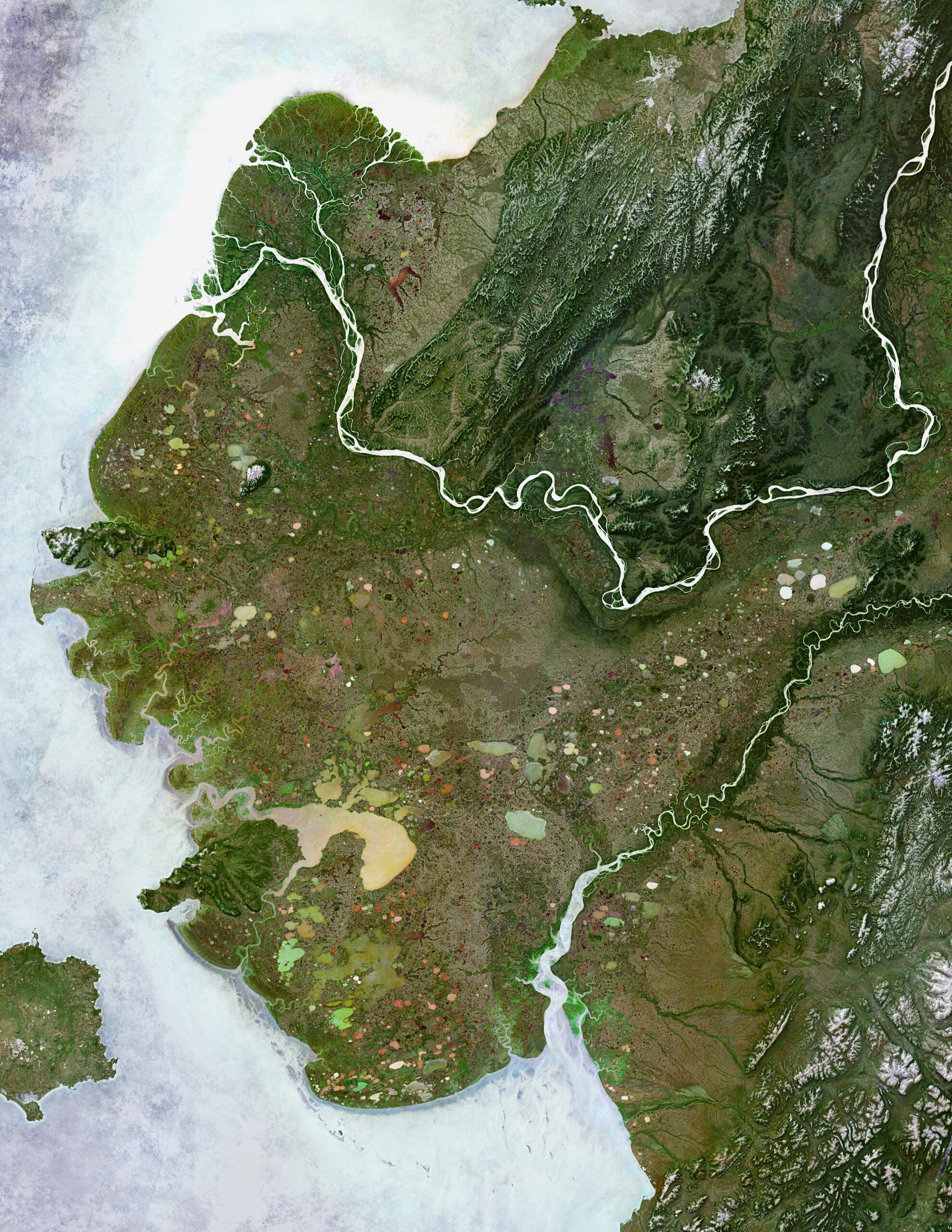
Map of the diverse ecosystem of Alaska’s Yukon-Kuskokwim Delta
This is a satellite image mosaic for the Yukon-Kuskokwim Delta region of Alaska using bands 2,3,4, and 8 of Sentinel2 data (Copernicus Sentinel-2 mission, ESA). The unique coloring of the water features comes from blending via “pin-lighting” the normalized wetness index (NDWI via bands 8 NIR and 3 Green) with the natural color pixels derived from bands 4,3,2 (R,G,B). This approach allowed us to enhance the natural color differences in only the wettest portions of the image mosaic. Young researchers as a part of Woodwell Climate’s Polaris project have used this image and data to drive field sampling trips within this region. Subsequent in-situ water geochemistry lab results match the unique color differences in the image.
Attribution:
Greg Fiske / Woodwell Climate Research Center
This map can be shared in its original format only. Appropriate attribution and credit must be given.
Data sources:
Copernicus Sentinel2, ArcticDEM
Go to top