For Alaska Native communities, maps are an essential resilience tool
- Features
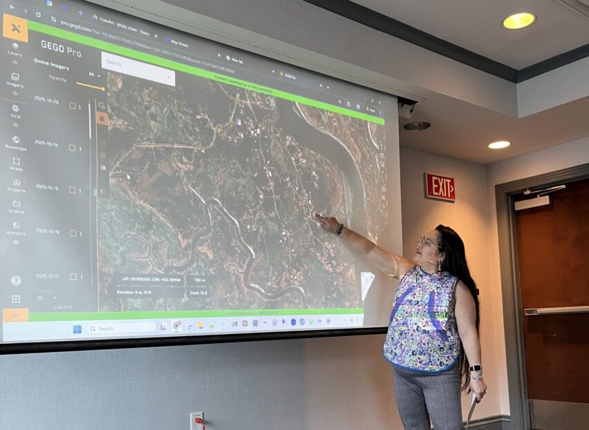
Lucy Martin sharing Typhoon Halong’s impact on her community. Photo by Greg Fiske / Woodwell Climate Research Center
In the wake of Typhoon Halong, a GIS workshop helped communities map the true extent of storm impacts
In October 2025, community partners from across Alaska gathered in Anchorage for a hands-on GIS and community mapping workshop organized through the Permafrost Pathways project. It was meant to be a space for learning and an opportunity to build technical skills using digital mapping software and working with environmental data. But in the wake of a devastating storm, what was initially a straightforward training became a real-time response to a region in crisis.
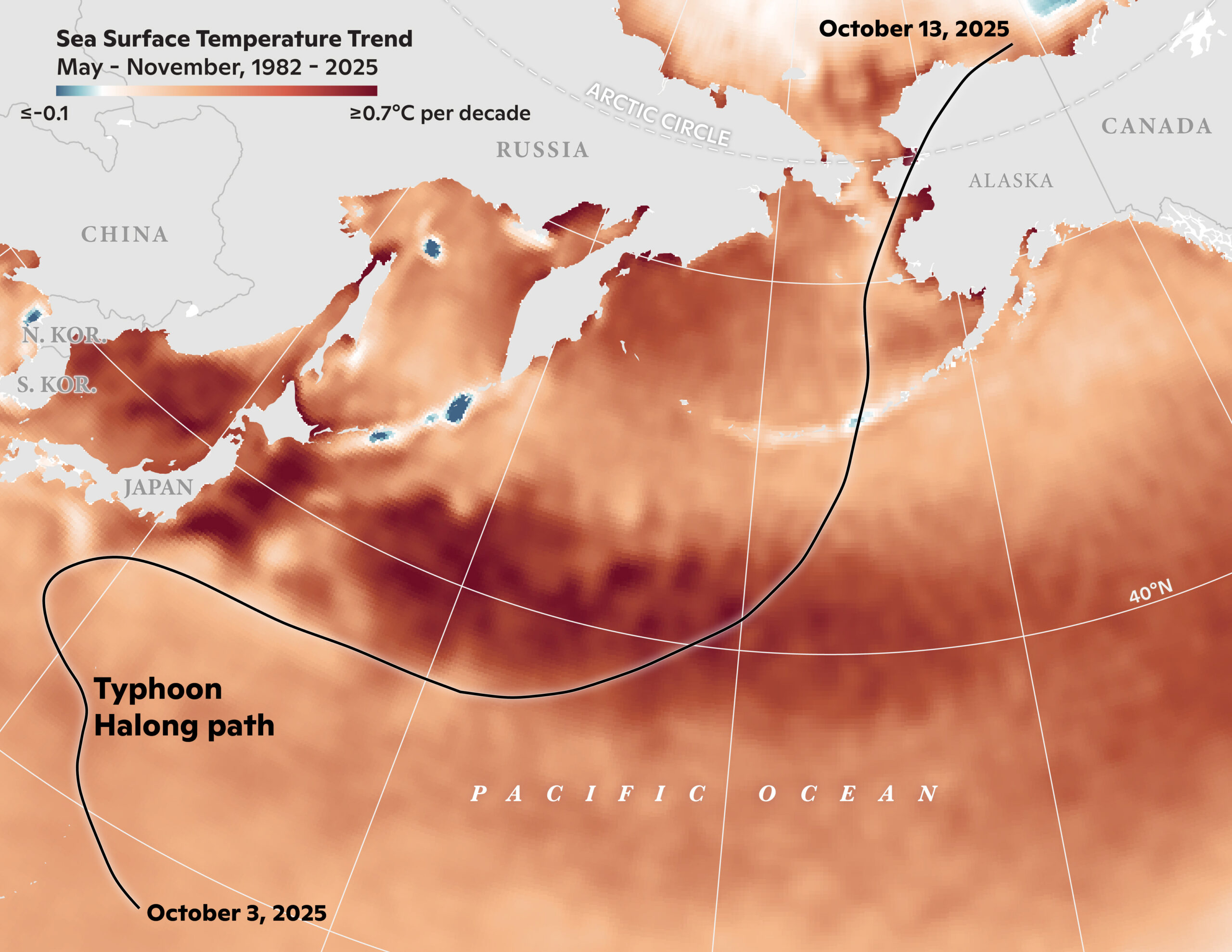
Sea surface temperatures have been rising due to climate change, shifting tropical storms northward.
Map by Christina Shintani / Woodwell Climate Research Center
A workshop taken by storm
Just weeks earlier, Typhoon Halong had torn through the Yukon-Kuskokwim Delta, devastating communities across western Alaska and displacing more than 1500 people.
Some of the workshop participants arrived in Anchorage from evacuation sites, rather than their home communities. Two participants had to be rescued from inside their homes as they floated away during the storm. Despite the option to postpone, Tribal representatives expressed interest in having the workshop anyway, knowing that mapping their land, their losses, and their future could not wait.
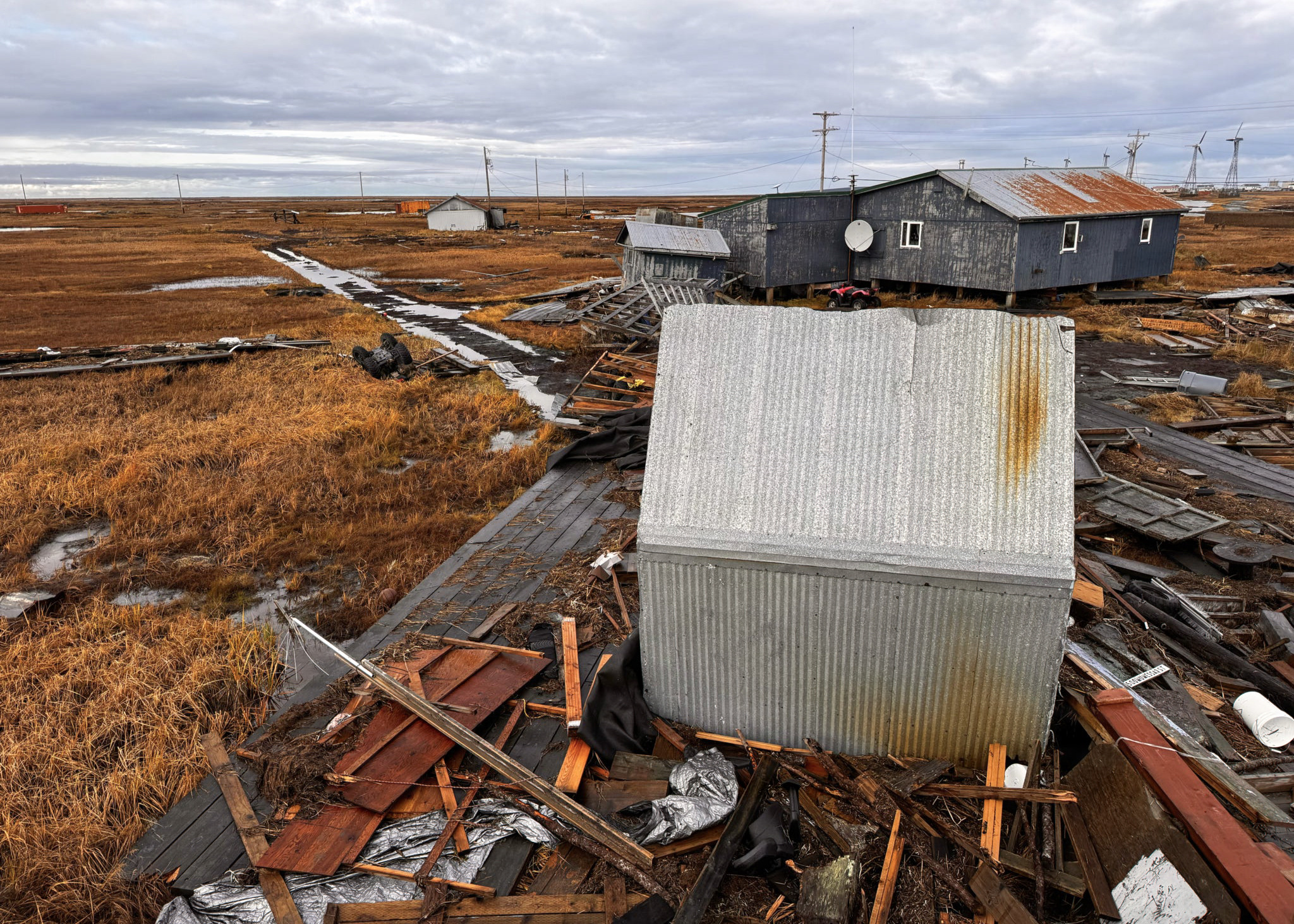
TOP: The Native Village of Qipneq (Kipnuk)in the wake of Typhoon Halong in October 2025. Photo by the Alaska National Guard
BOTTOM: Alaska Air National Guard evacuating displaced western Alaska residents from Bethel, Alaska. This photo was altered for privacy purposes by blurring out faces. Photo by Staff Sgt. Joseph Moon / Alaska National Guard
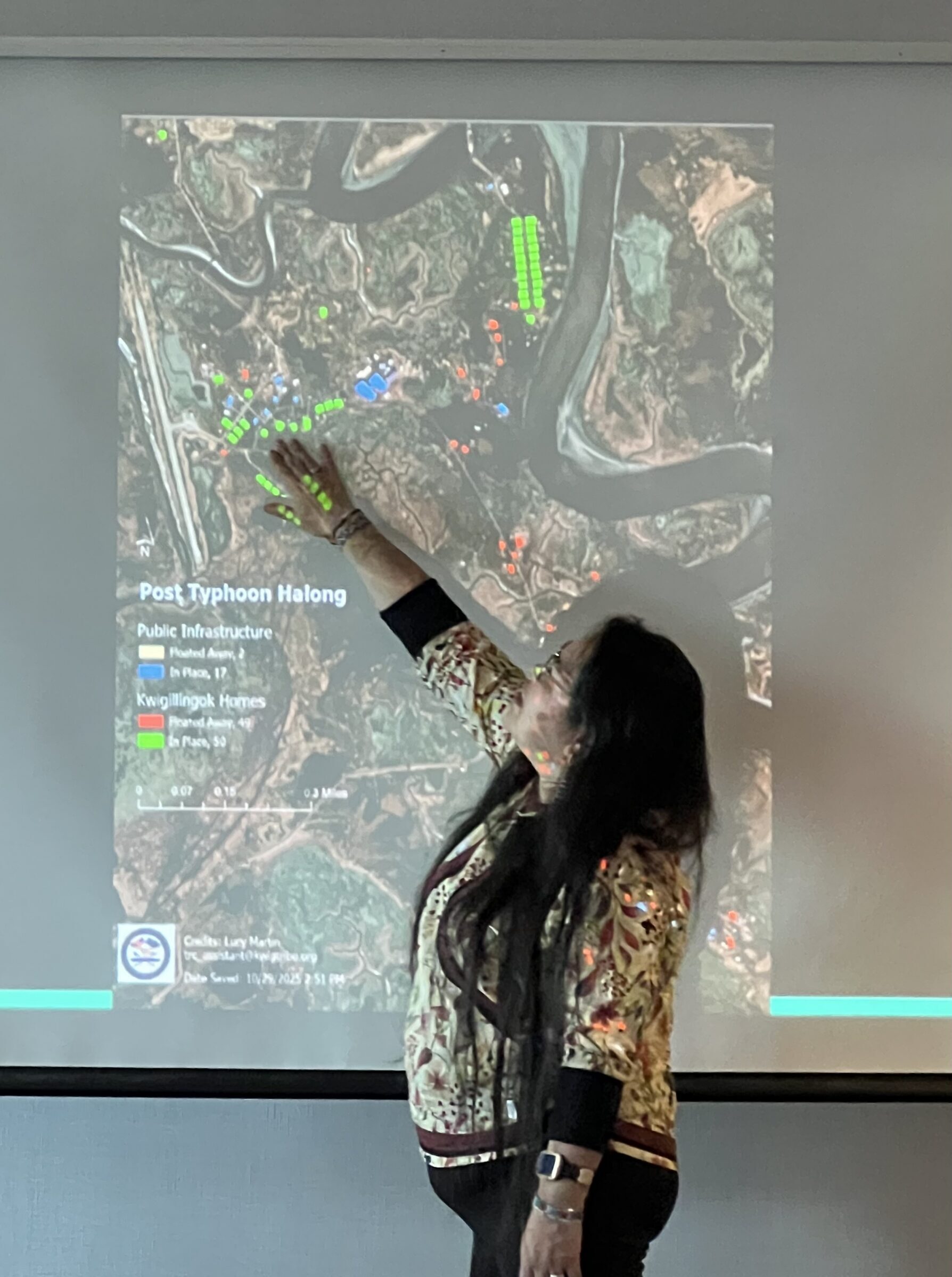
“I’m one of the victims of the typhoon that floated away while I was inside my house,” said Lucy Martin, Tribal Resilience Planning Assistant for the Alaska Native Village of Kuigilnguq (Kwigillingok)—one of the hardest hit communities. “In Kuigilnguq, 46 houses fell off their foundations and floated away. Many are still in the river or out in the ocean. Fifty-three homes stayed put, but there is external damage.” Along with several gravesites, Martin said nearly all of the community’s transportation routes, commonly known as boardwalks, were completely washed away.
The experience of workshop participants underscored a sobering reality that many Alaska Native communities are living every day: in the Arctic, climate change is not abstract. It is already here and northern communities are having to plan for climate change while being on the frontlines at the same time.
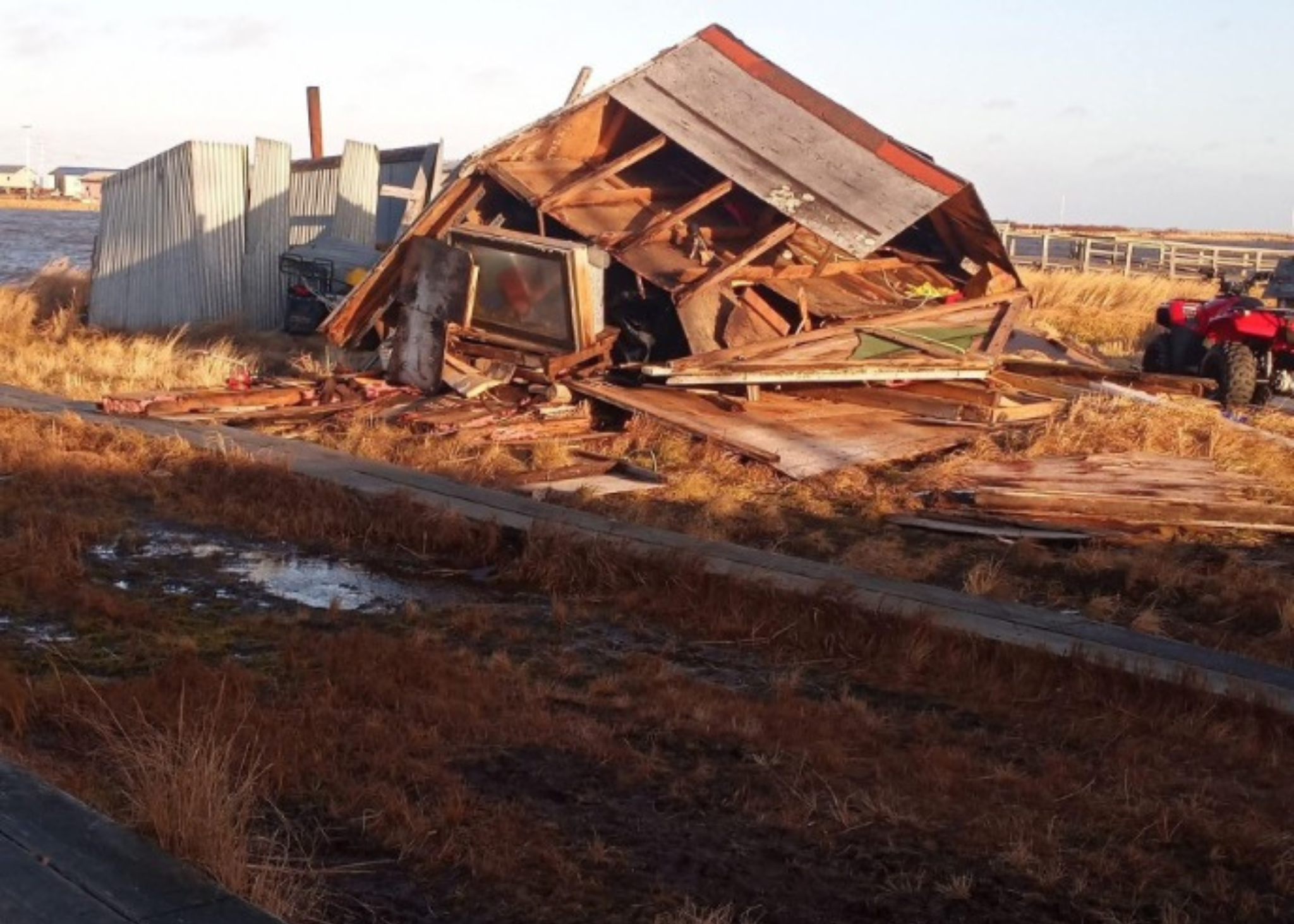
TOP: The Native Village of Kuigilnguq (Kwigillingok)in the wake of Typhoon Halong in October 2025. Photo by the Alaska National Guard
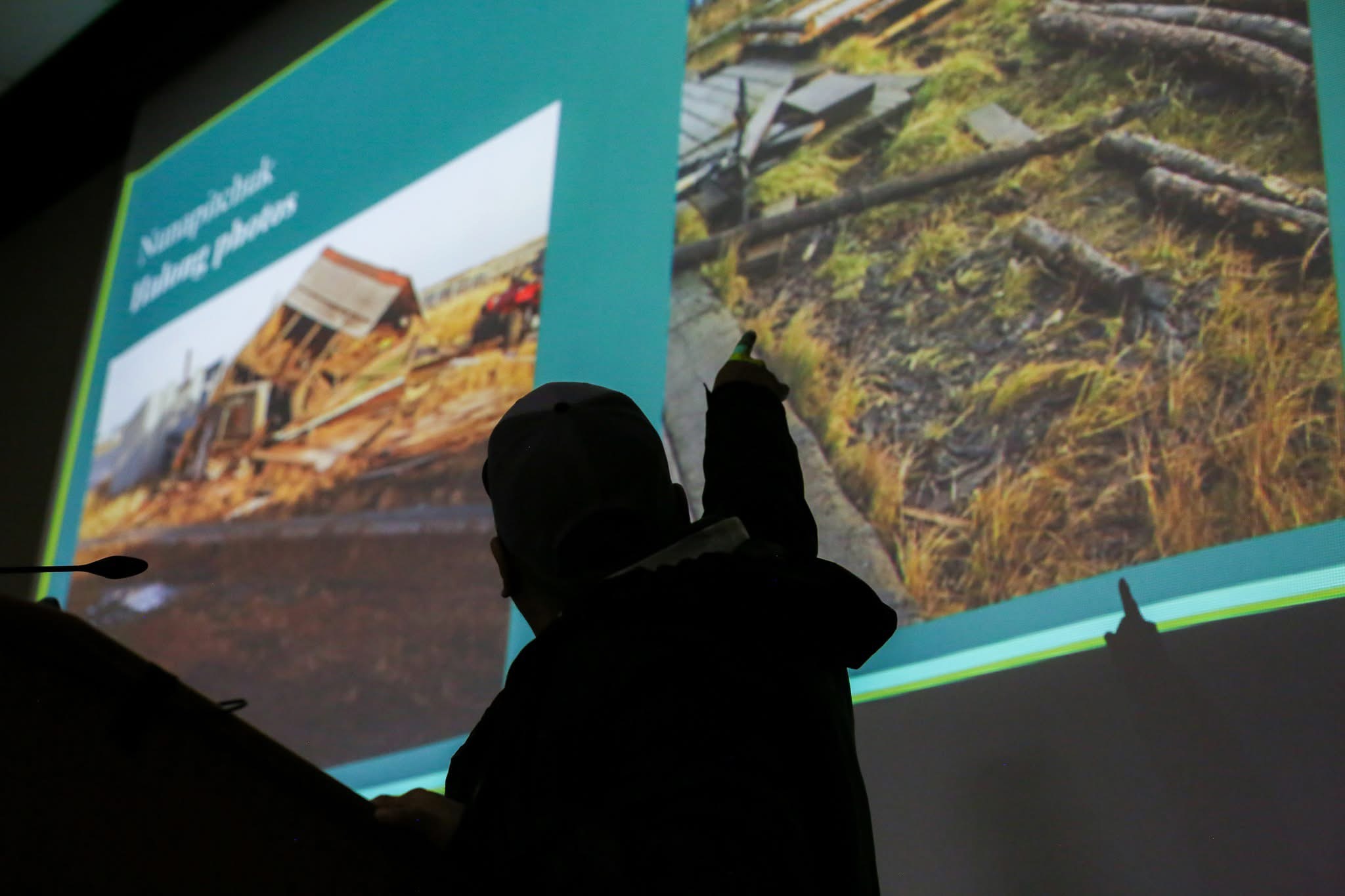
BOTTOM: Damage in Nunapicuaq (Nunapitchuk) after the typhoon. Vincent Wassillie / Native Village of Nunapicuaq
Even in Nunapicuaq (Nunapitchuk), which is located more inland and where storm impacts weren’t quite as severe, wind gusts up to 77 mph were recorded by the community’s weather station. They also saw damage to subsistence structures and a few homes.
“My community wasn’t severely impacted,” said Vincent Wassillie, Tribal Liaison for Nunapicuaq. “But a few homes had minor damages and fish drying racks and smoke houses suffered the most. Some even collapsed from the wind and multiple cabins were blown from their foundations.”
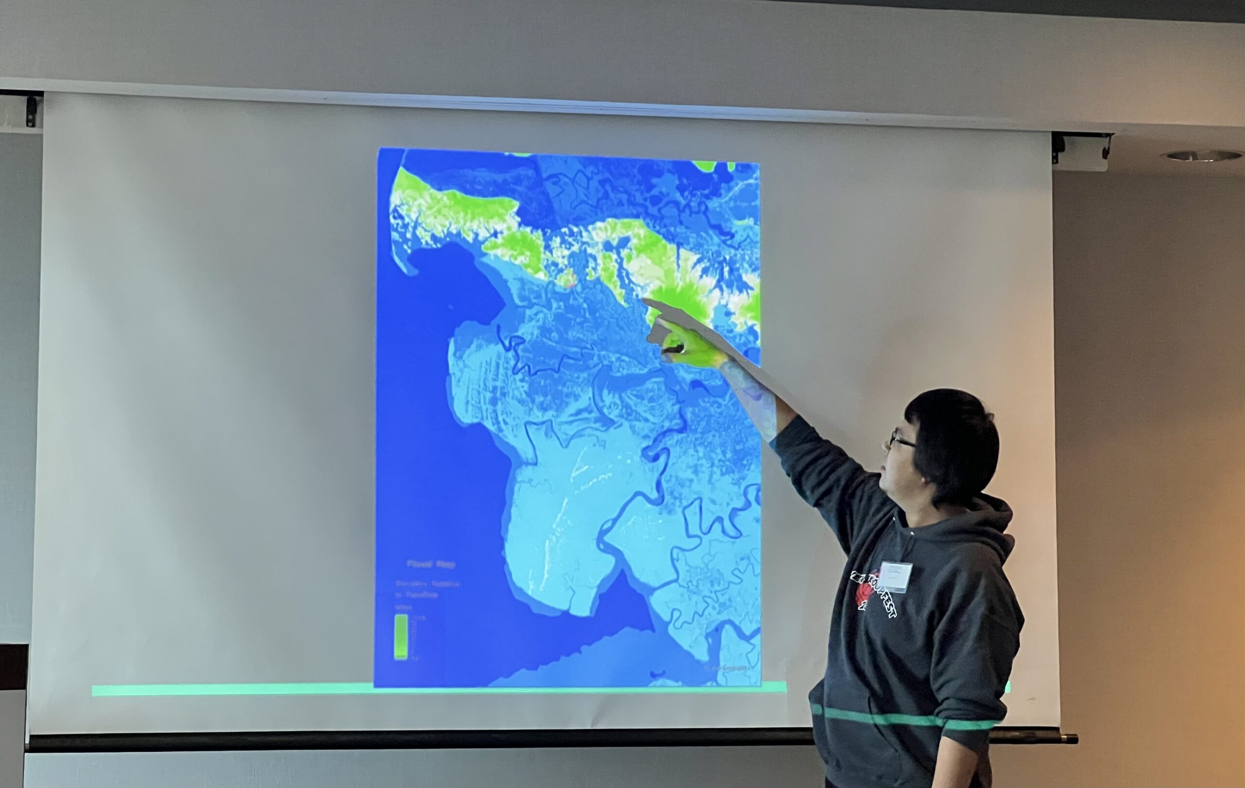
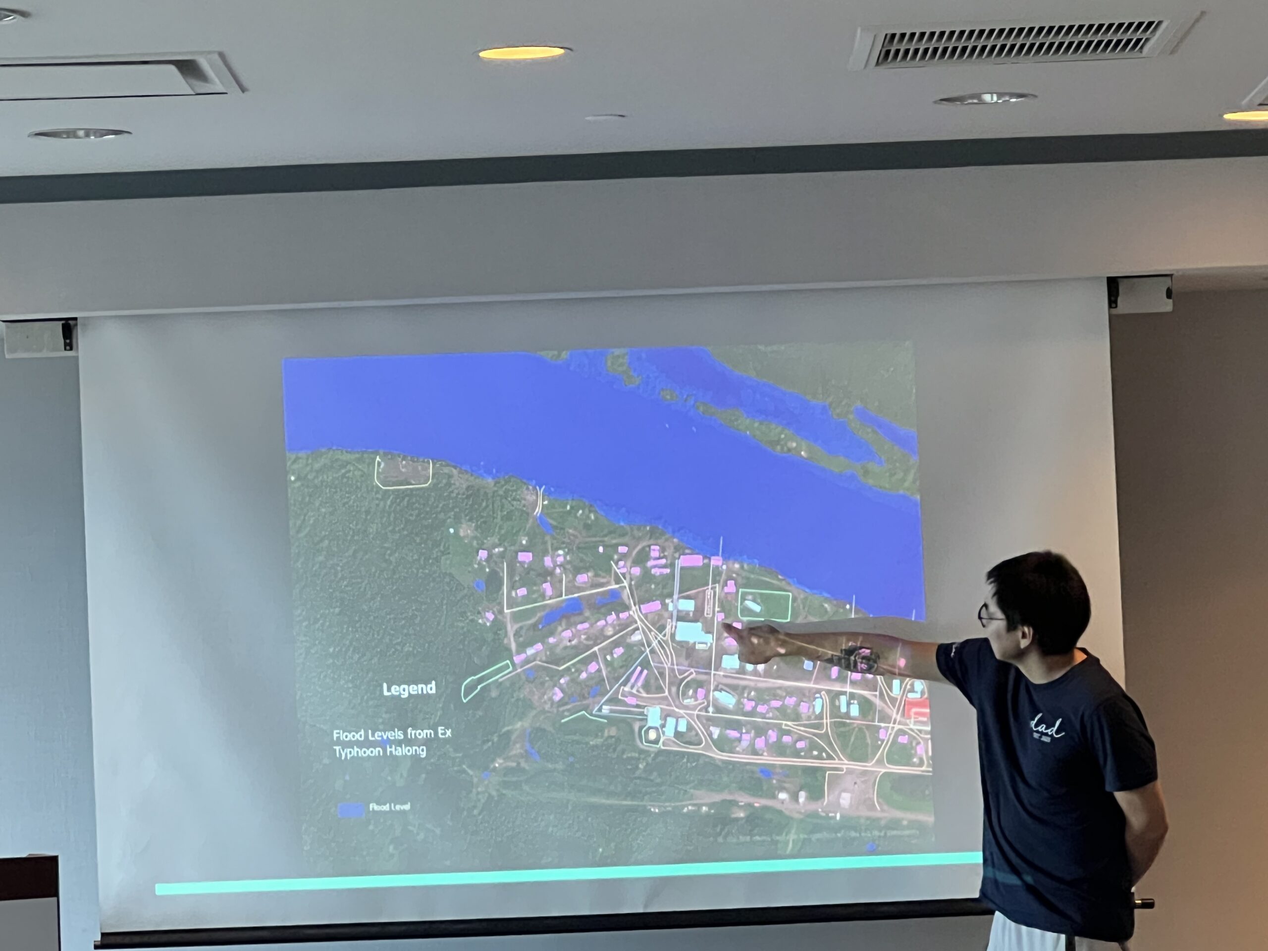
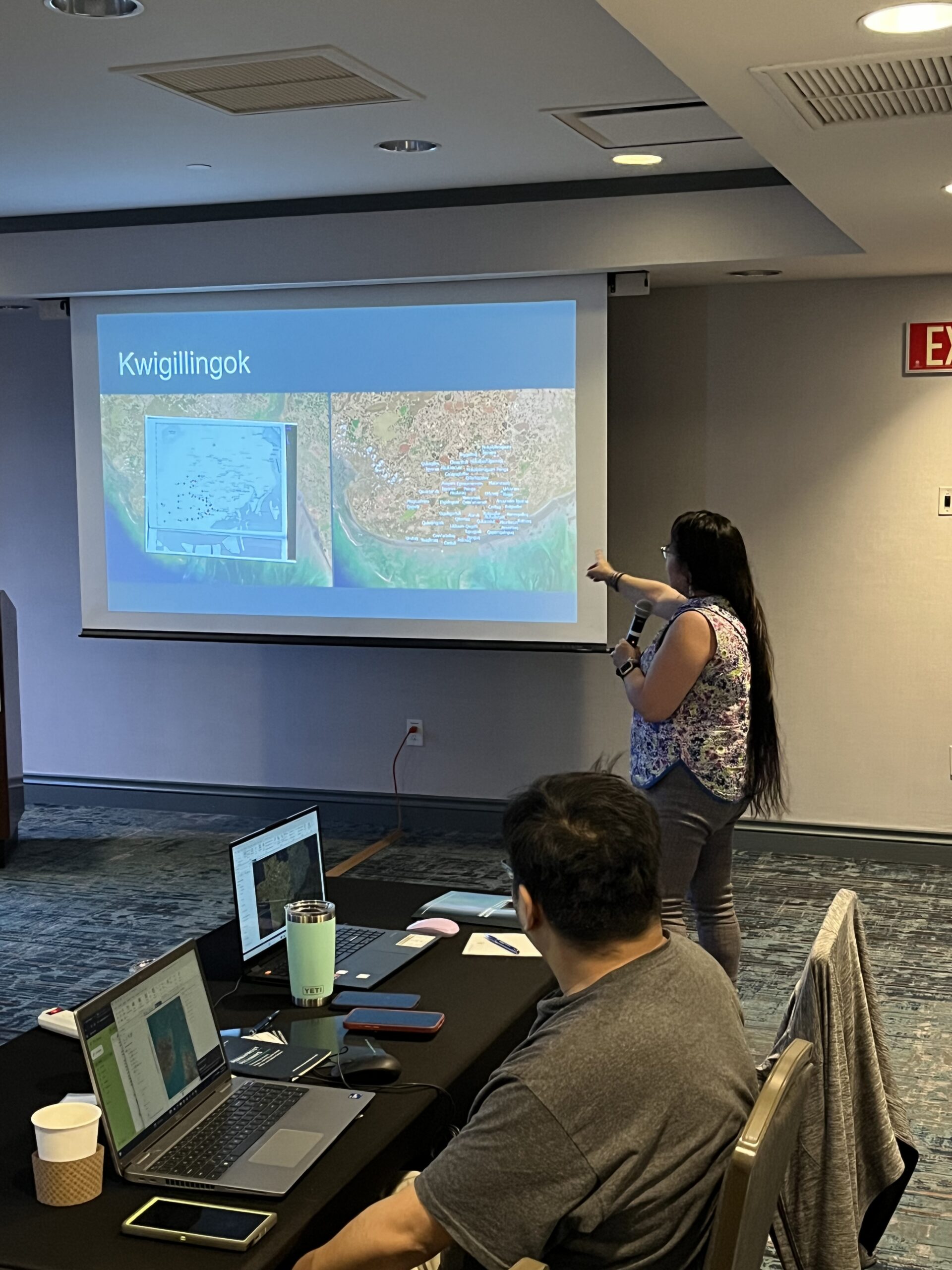
Reggie Tuluk presenting a flood map of the Native Village of Cev’aq during the 2025 GIS workshop.
Photo by Amanda Poston / Woodwell Climate Research Center
Maps have become critical tools for climate resilience
The storm highlighted a growing trend across the Arctic: storms are becoming more intense because of climate change, compounding effects of permafrost thaw, and threatening vulnerable infrastructure and community ways of life.
Many communities had not yet recovered from Typhoon Merbok in 2022 before Halong barreled through the Yukon-Kuskokwim Delta just three years later. Over the past few decades, typhoons—which usually form over the Equatorial Pacific Ocean—have been pushing farther north, sometimes making it as far as Alaska. Increases in sea surface temperature, combined with loss of coastal sea ice, is creating conditions for more frequent and intense typhoons in Alaska that exacerbate permafrost thaw and erosion.
With support from Woodwell Climate Research Center, Alaska Native communities have been turning to GIS tools to help communicate the extent of this new reality.
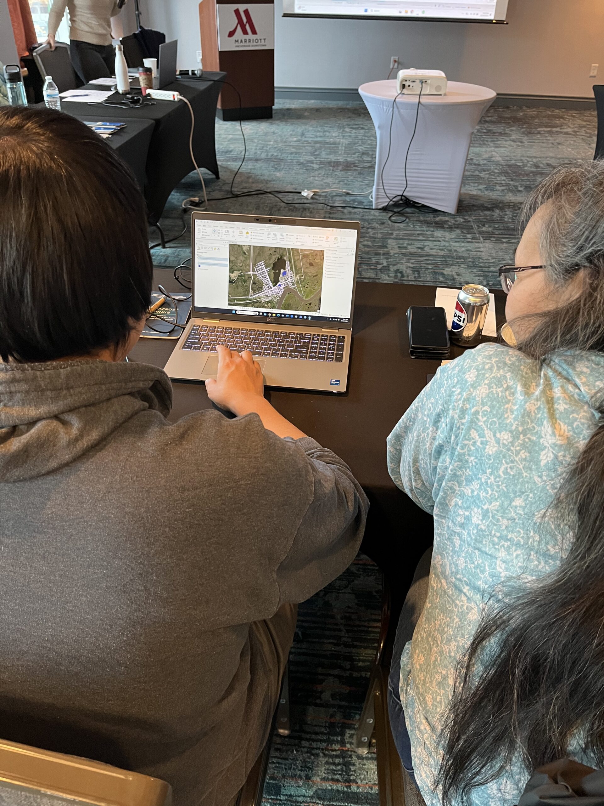
Co-organized by Research Assistants Jackie Dean and Tiffany Windholz, with input from GIS and cartography experts Greg Fiske and Christina Shintani, the October workshop built on a 2024 training, where communities participated in tutorials and lectures and shared stories about their communities. Since then, community members have been using GIS tools to map threats like flood risk and permafrost thaw, and put traditional Yup’ik and Cup’ik place names back on the map. This second workshop, which also included a listening session with representatives from U.S. and state congressional offices, expanded upon these skillsets through real-time response to Typhoon Halong’s impact on the region.
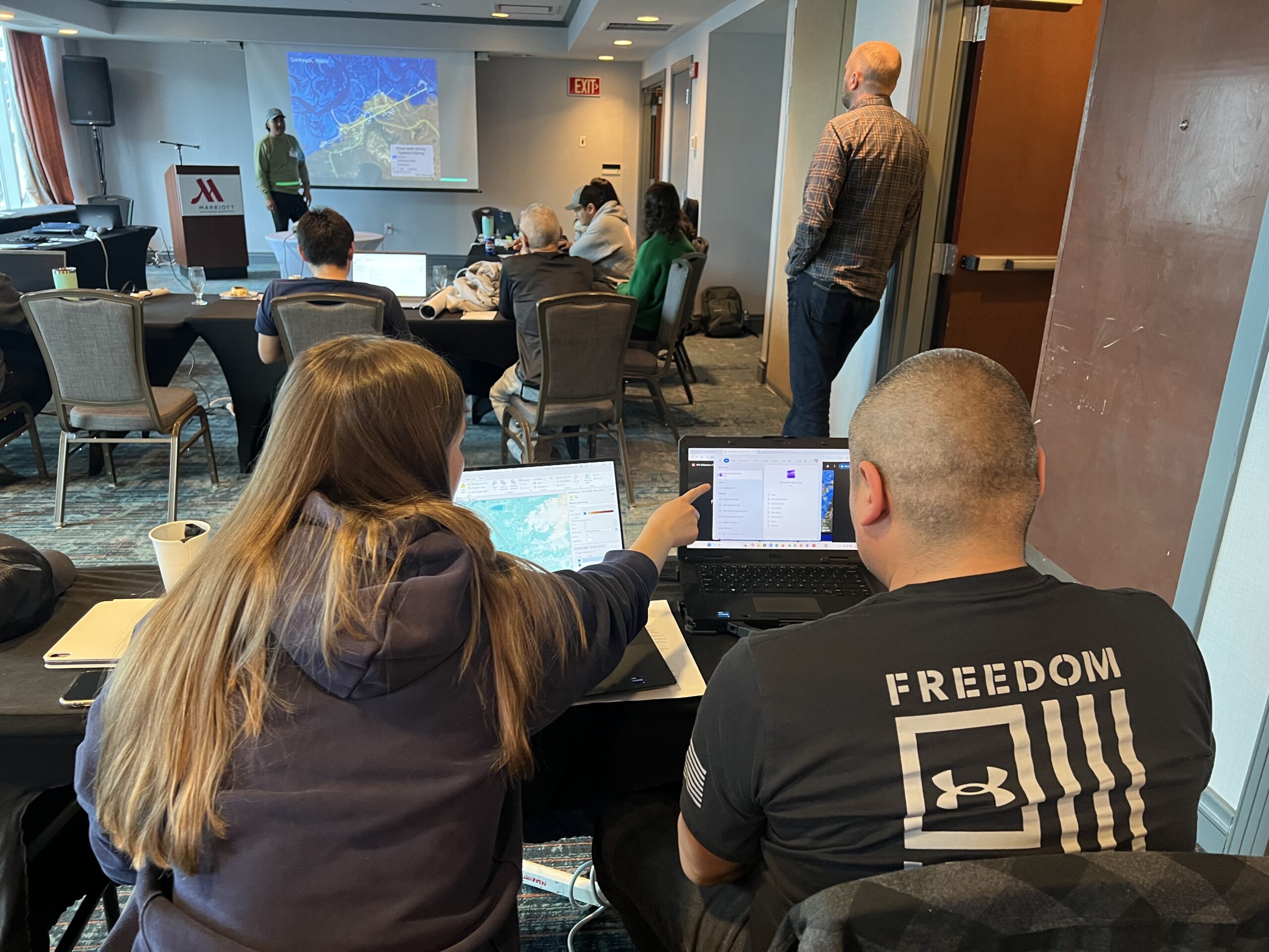
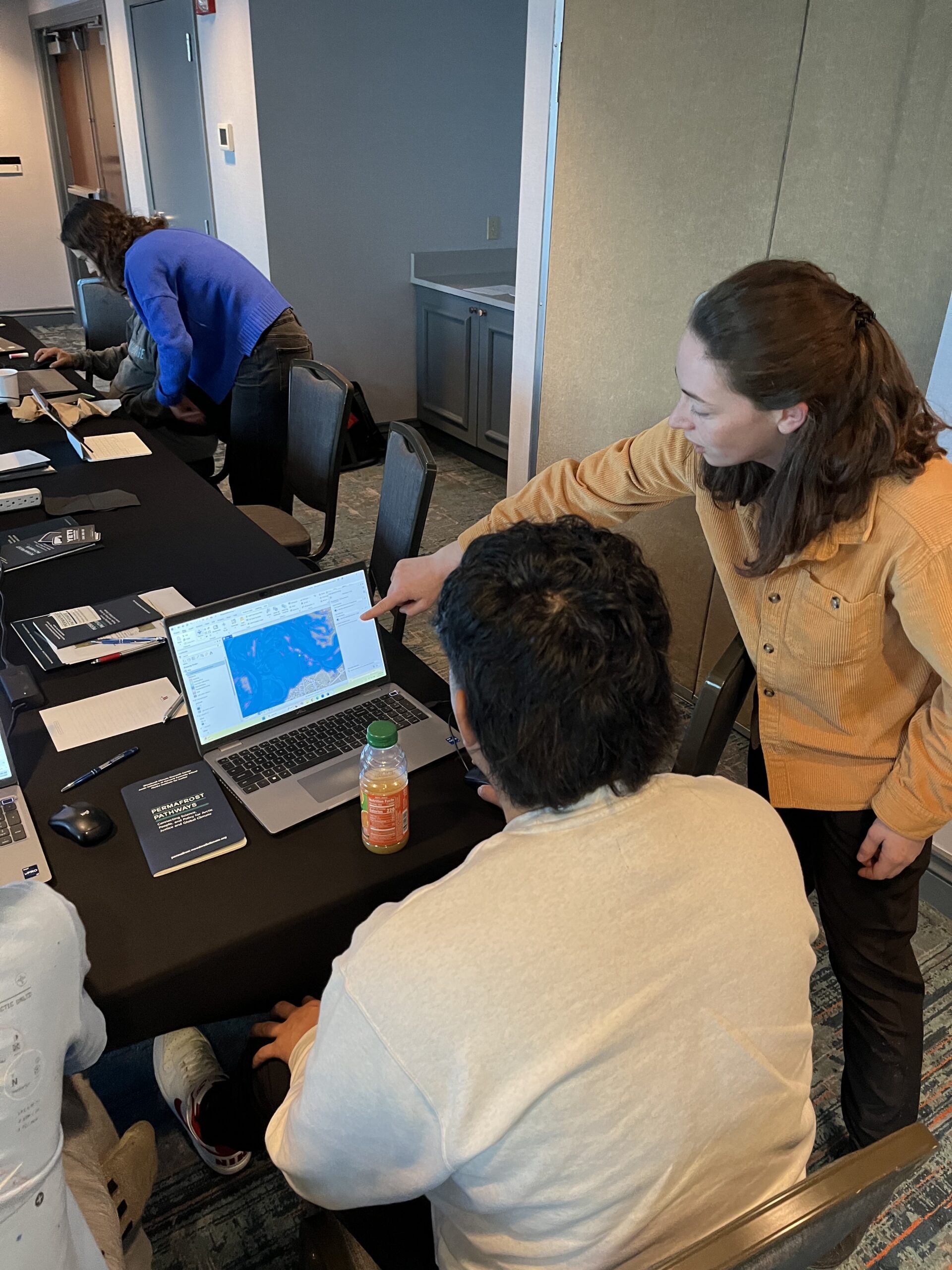
TOP: Tiffany Windholz and Brian Carl from Kipnuk working on a flood map during the 2025 GIS workshop. Photo by Amanda Poston / Woodwell Climate Research Center
BOTTOM: Jackie Dean and Jessie Dock-Paul of Kwethluk working on a community map of Typhoon Halong impacts at the GIS workshop. Photo by Greg Fiske / Woodwell Climate Research Center
Workshop sessions began with stories to ground the technical work in community experience. Participants introduced their homes, their landscapes, histories, and ways of life. Using digital maps of their villages, they shared what made their communities unique.
Then, Tribal representatives turned to creating maps that would be most relevant to their communities, using drone and satellite data to map erosion, flooding and other risks. Representatives from two communities most impacted by Typhoon Halong—Kuigilnguk and Qipneq (Kipnuk)—worked on infrastructure maps that revealed the true extent of storm damage. For participants, these activities were not hypothetical exercises, but rather maps of homes, roads, and infrastructure that had just been lost.
“Our goal is to share GIS skills so that community partners can make their own maps, tell their own stories, and use maps for decision-making, which is already happening,” said Dr. Susan Natali, George M. Woodwell Chair in Conservation and Permafrost Pathways Lead. “What I observed and participated in at this workshop was really incredible, because in a year’s time since our first workshop, participants have gained technical GIS skills to incorporate their place-based knowledge into maps to guide decision-making driven by communities’ needs and expertise.”
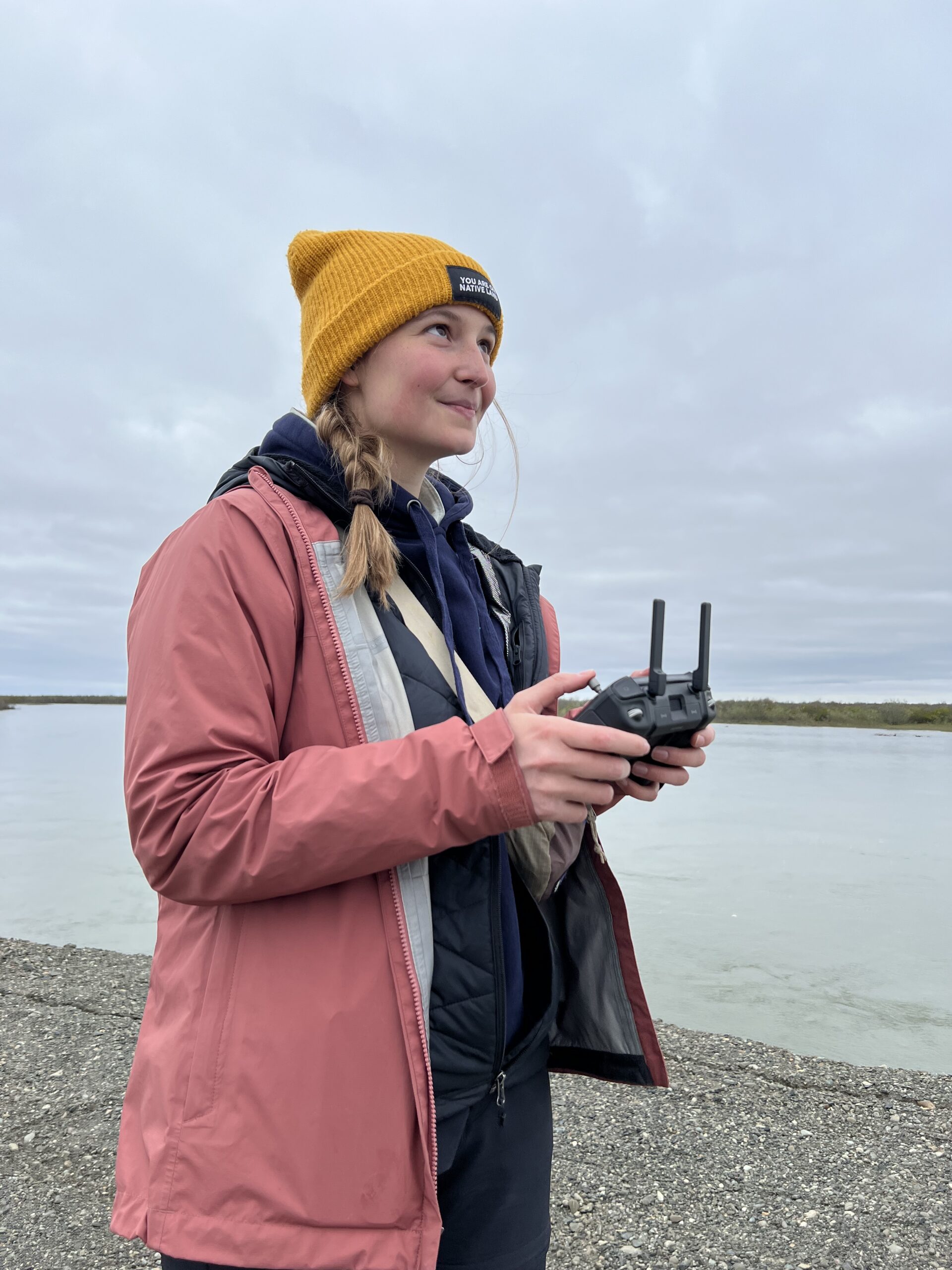
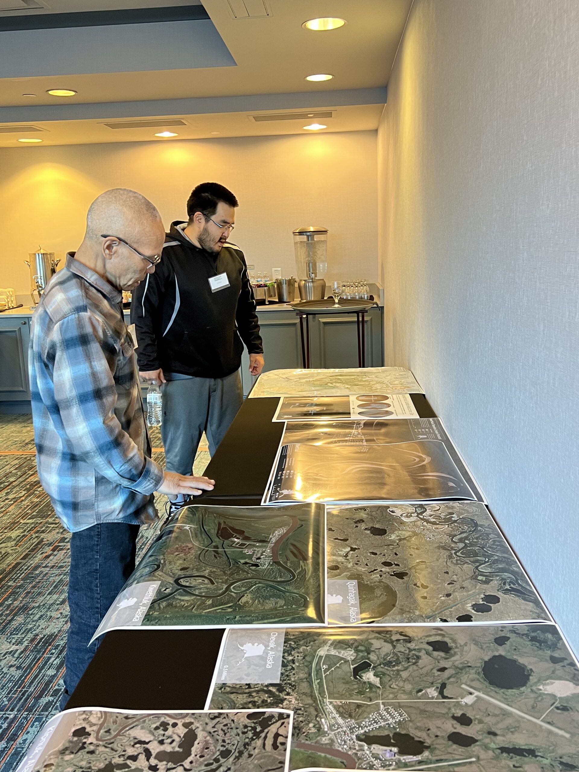
Tiffany Windholz and Preston Alexie using drones to document erosion in Quinhagak, Alaska. Photo by Christina Minions / Woodwell Climate Research Center
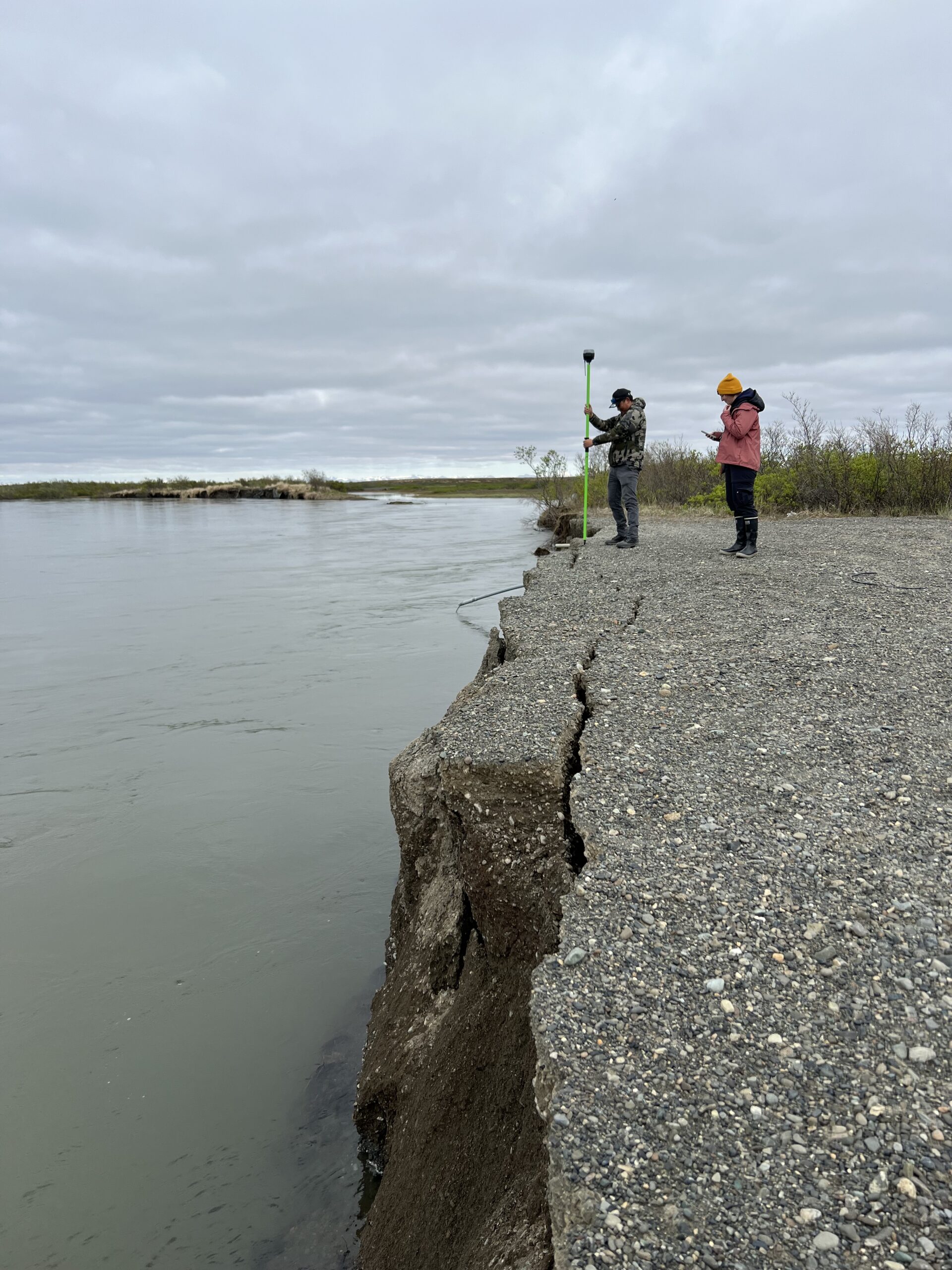
To help map environmental change in communities, you need high-resolution imagery to see the finer details, like the rate of erosion from year to year. What makes this challenging is that southwestern Alaska is often cloudy, making high-resolution imagery hard to come by. To help address this, Permafrost Pathways is starting a drone program to support interested community partners in obtaining a drone pilot license, an effort led by Windholz. Drones can fly below the cloud ceiling, making it easier to monitor and map local points of interest.
“We fully understand the challenges of making maps in rural areas. Data are very limited and can quickly become out of date,” said Windholz. “To better support our community partners and their needs, we’re expanding into including drones in our work. Some members on the team already have their license and some folks are studying and will be testing very soon as we continue to build out this program. Making the transition from providing maps and drones as a service to prioritizing capacity-building and knowledge sharing has made the biggest difference in the work that we do.”
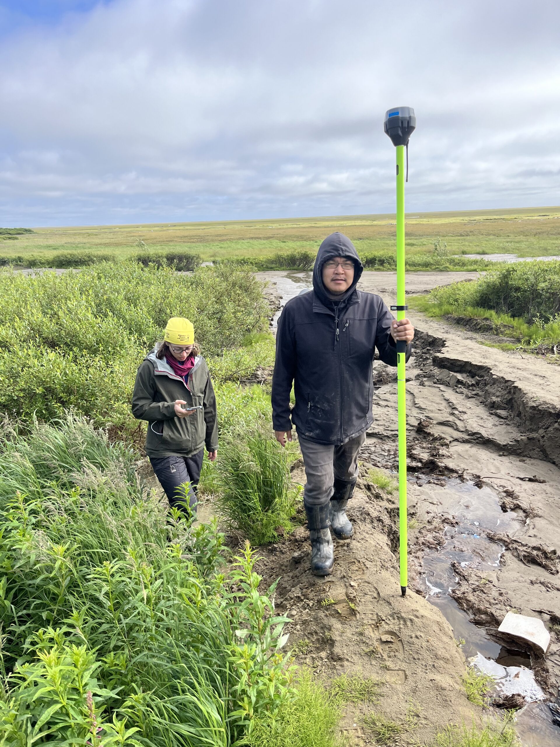
Jackie Dean and Reggie Tuluk measuring river erosion in Cev’aq, Alaska. Photo by Sue Natali / Woodwell Cliamate Research Center
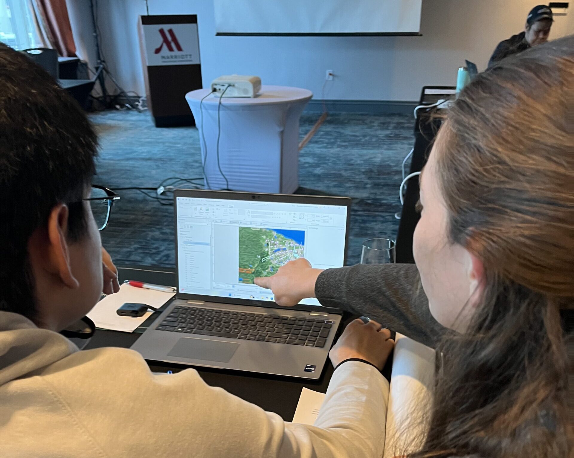
Jackie Dean and Preston Alexie developing a flood map of Quinhagak, Alaska at the 2025 GIS workshop. Photo by Greg Fiske / Woodwell Climate Research Center
At the heart of the mapping is a core philosophy that challenges traditional scientific approaches: real collaboration begins with listening. Rather than prescribing the same basic data or pre-designed tutorials, Dean and Windholz have spent several years working with community partners to understand the most relevant uses for GIS among communities.
“We are really trying to build the technical knowledge and skill sets so that when people need maps in the future, they can make them themselves and know how to do it,” said Dean. “Towards that goal, we are continuing our weekly map meetings and just meeting with folks whenever they want to try to help them continue to make maps that actually meet their needs.”
TOP: Community members from Akiak, Alaska discussing traditional place names. Photo by Jackie Dean / Woodwell Climate Research Center
BOTTOM: Morris Alexie, Dr. Sue Natali, and Jackie Dean in Nunapicuaq, Alaska. Photo by Jessica Howard / Woodwell Climate Research Center
When locals lead, truth and accuracy follow
For many participants, the workshop reinforced something they’ve always known: solutions are strongest when they come from communities themselves. Martin’s map from the workshop is a powerful example of this.
While government and media sources were reporting only 35% of infrastructure damaged in Kuigilnguk following Halong, Martin’s map showed 50% of homes had completely floated away and 100% of homes suffered damage. The community also lost 90% of its boardwalk transportation system. Overall, Martin’s map revealed 100% of Kuigilnguq’s infrastructure was damaged. During the workshop’s listening session, Martin presented her personal Halong experience to a rapt audience of policy representatives. When she shared her map documenting Halong’s damage to her community, the stark visual impact drew audible gasps from the room.
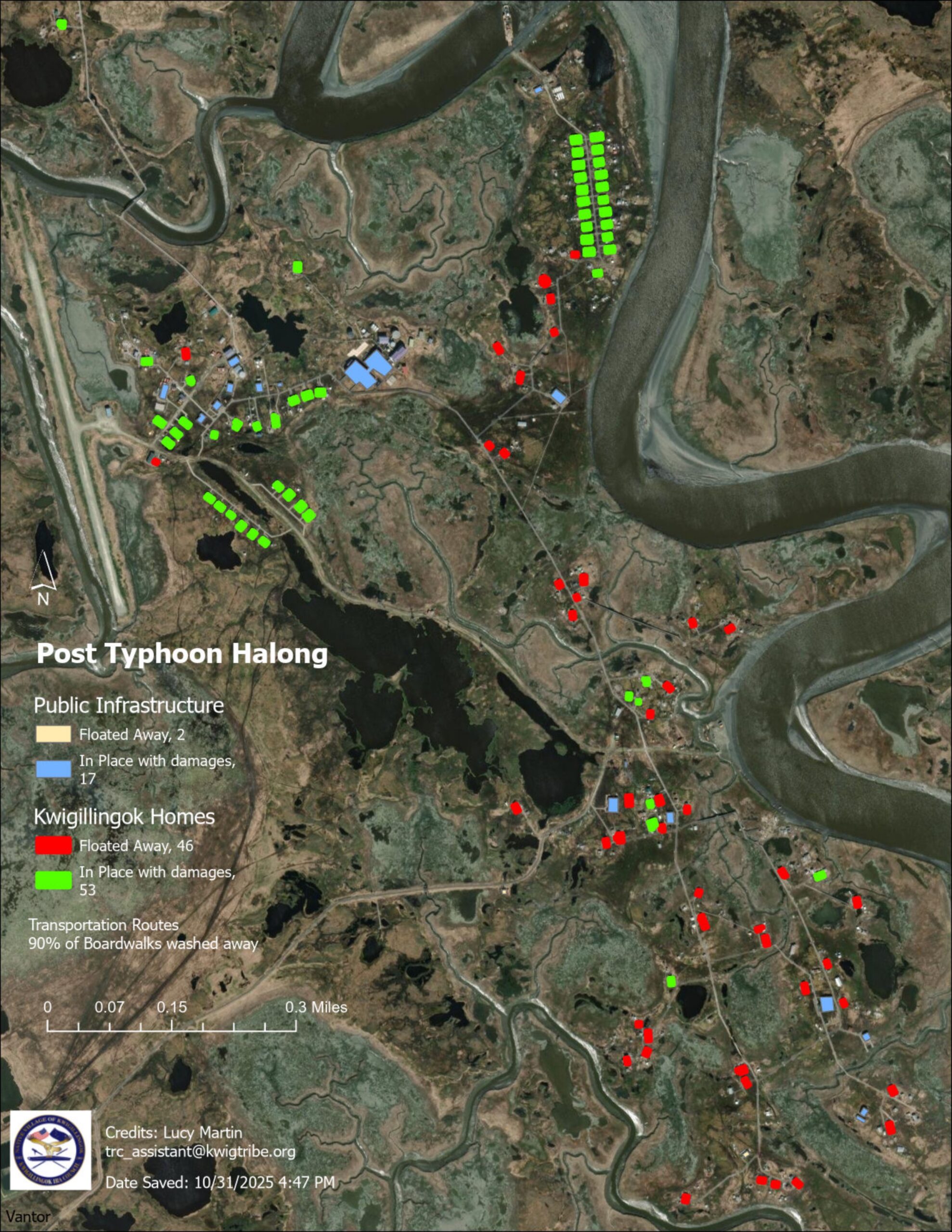
Map by Lucy Martin / Native Village of Kuigilnguq
“I also created a list of people who live in each home … for a head count, to make sure everybody’s accounted for,” said Martin. Her work to document and map each household helped the Federal Emergency Management Agency verify individuals who were in the community during the typhoon with more accuracy than could have been achieved otherwise.
“It’s more beneficial for locals … having that trust already there rather than flying in external people from the lower 48,” said Reggie Tuluk, Tribal Liaison for the Native Village of Cev’aq (Chevak). “Local people know the land.”
A community-led approach offers a more equitable solution than traditional disaster response models that rely heavily on outside experts. According to Arctic Adaptation Lead Darcy Peter, who is Koyukon and Gwich’in Athabascan from Beaver, Alaska, outsiders lack local context and building trust from scratch can take time that communities can’t afford to lose in an emergency. Additionally, data collected externally often misses culturally significant information and local considerations.
Lucy Martin presenting her infrastructure map of Kuigilnguq at the 2025 GIS workshop following Typhoon Halong. Photo by Amanda Poston / Woodwell Climate Research Center
Reggie Tuluk and Cynthia Paniyak of Cev’aq working on a map at the 2025 GIS workshop. Photo by Greg Fiske / Woodwell Climate Research Center
“Alaska Natives, and Indigenous People in general, have historically been excluded from major decision-making conversations because of the lack of value in Traditional Knowledge either at all, or as much as Western science,” said Peter. “These entities that have the decision-making power have institutional scientists, economists, map-makers, lawyers, etc. in their back pockets who take approaches that rarely align with Traditional Knowledge and local expertise. Tribes being their own expert map-makers, scientists, and so on, fills that huge gap that’s missing during these conversations.”
Several Tribal Liaisons presented their workshop maps during a session at the 2026 Alaska Forum conference held on Dena’ina lands in Anchorage earlier this year. With a jam-packed room, mostly made up of other community representatives, workshop participants shared how local GIS expertise and access to these tools have made positive impacts on their communities.
“For me, personally, I learn better by being more hands on, and I like seeing results,” said Tuluk. “GIS mapping and now adding to that with drones has made me understand the work that we do better and exploring different ways we can go about certain issues that we’re dealing with in our community.”
TOP: Vincent Wassillie presenting about Nunapicuaq (Nunapitchuk) during the 2026 Alaska Forum. Photo courtesy of the Alaska Forum
BOTTOM: Jessie Dock-Paul, Tribal Liaison for the Native Village of Kuiggluk (Kwethluk) presenting the map he made of his community following Typhoon Halong. Photo by Amanda Poston / Woodwell Climate Research Center
Keeping power in the hands of communities, indefinitely
The Permafrost Pathways team hopes these workshops will be the beginning of a powerful Alaska Native mapping network. Communities expressed interest in creating maps of evolving weather conditions through winter and spring ice breakup. Additionally, a drone workshop is being planned for Spring 2026 in the Permafrost Pathways partner community of Quinhagak (Kwinhagak) to recruit and train more local drone pilots in an effort to advance and expand community-led GIS capacity-building.
“I would encourage other community members to have at least one or two people within their Tribe or community to learn GIS and become licensed drone pilots,” said Tuluk. It’s important with our land changing due to climate change and our people have that knowledge. Communities have that knowledge. They also have that trust and can use drones to collect their own data and make their own planning decisions.”
Lucy Martin presenting her traditional place name map for Kuigilnguq, Alaska. Photo by Greg Fiske / Woodwell Climate Research Center
Morris Alexie of Nunapicuaq and Julius Carl of Kuigilnguq with aerial maps of communities in Western Alaska. Photo by Amanda Poston / Woodwell Climate Research Center
Participants also expressed interest in providing remote GIS technical support for villages preparing FEMA submissions, infrastructure repair requests, or relocation planning while continuing to build a community of practice among Alaska Native mappers, so villages aren’t working in isolation when the next storm arrives.
As Halong’s aftermath continues to unfold, these maps will guide not just recovery, but long-term resilience and cultural continuity. For Martin and Kuigilnguq, community-led GIS is helping to advance climate adaptation—which for Kuigilnguq, requires community-wide relocation.
“My village is using GIS mapping to identify a potential relocation site for our entire community,” said Martin.
Both Martin and Tuluk are also creating maps of their communities to support language and cultural revitalization by mapping traditional place names.
“We felt that our traditional place names should be for future generations,” said Martin. “It can be useful for many purposes, including search and rescue. Future generations should know these places. Hopefully someday, they will be available on navigation tools like the GPS Garmin maps, publicly available to everyone.”
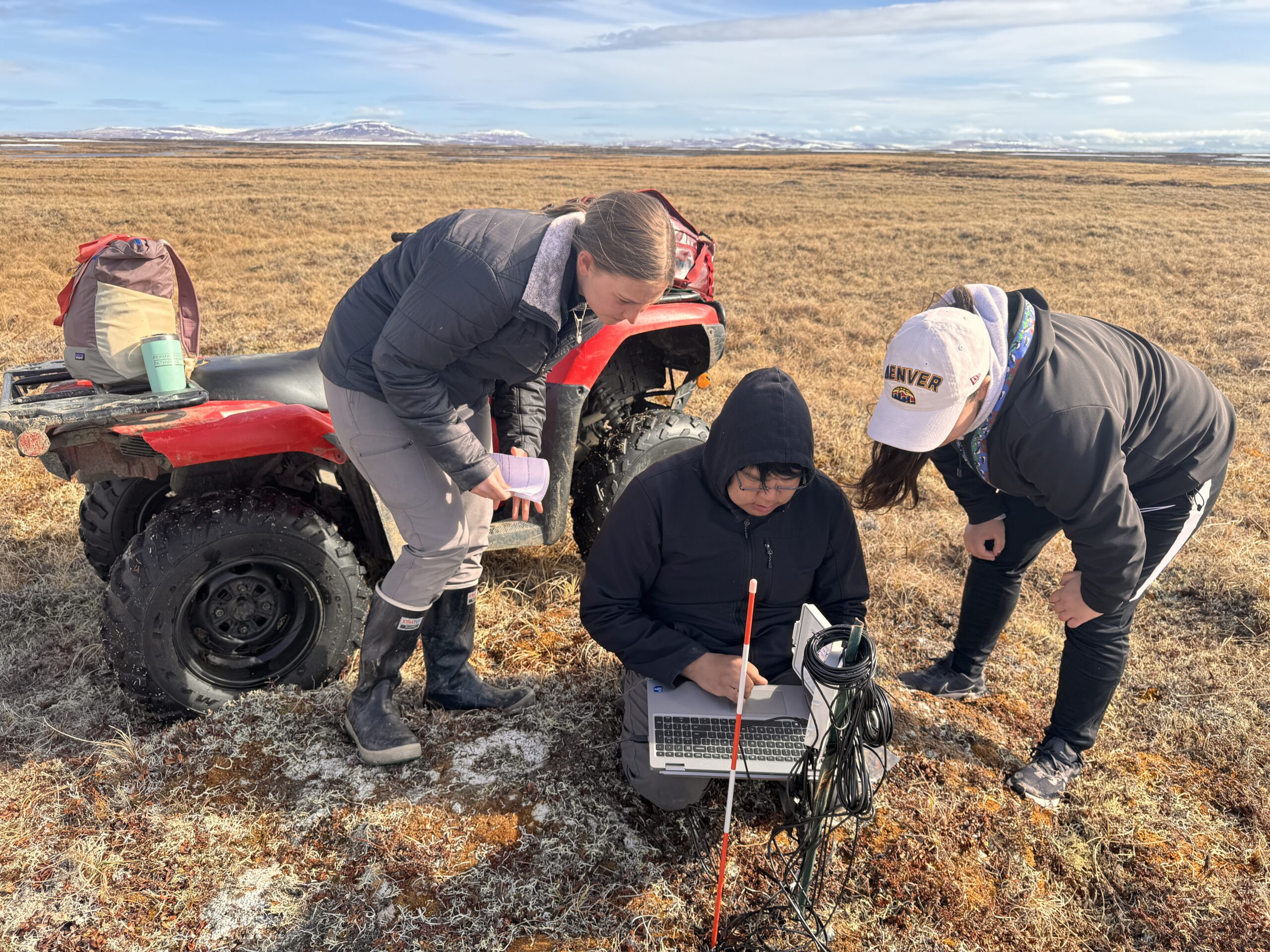
Tiffany Windholz, Reggie Tuluk, Permafrost Pathways Tribal Liaison for the Native Village of Cev’aq, and Darcy Peter downloading data from a temperature sensor. Photo by Aurora Taylor / Permafrost Pathways
For Peter, if there is any hope of adapting to a rapidly changing Arctic, it must come from the people who know it best and have called it home for millennia. When Indigenous communities can visualize their past and present, they gain something even more powerful—the ability to determine their own future on their own terms.
“I see GIS as a huge resource for Tribes,” said Peter. “The fact that Alaska Native communities are eager to learn just makes it all the more fulfilling and gives me so much hope for the future of this work for our people’s sovereignty.”
SPECIAL THANKS TO AMANDA POSTON AND TRACY BARQUINERO FOR THEIR INVALUABLE TIME, EFFORT, AND SUPPORT IN BRINGING THE GIS WORKSHOP TO LIFE.
Go to top