New study shows aquatic carbon emissions are sensitive to small shifts in climate
- Updates
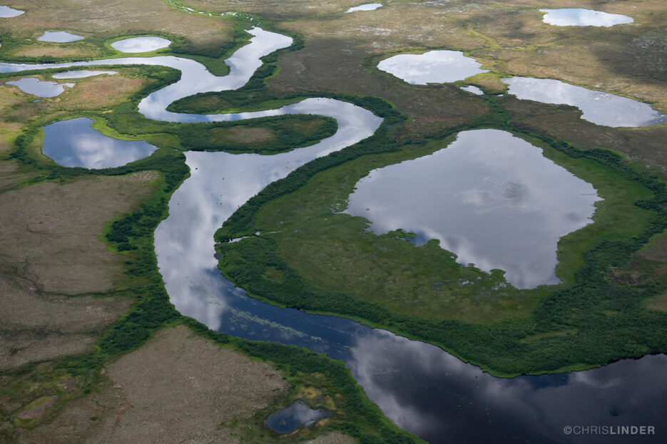
Lakes and rivers in the Alaskan tundra. Photo courtesy of Chris Linder
Researchers combine field data and modeling to predict emissions from Arctic lakes and ponds
From the air, the tundra of southwest Alaska appears like a kaleidoscopic tapestry, green and gold sedges and cottongrass shining amidst an expanse of blue lakes and ponds. Satellite data suggest about forty percent of the region is covered by freshwater, and on the ground this abundance can make the terrain seem, in places, more water than land.
Now a new study of two lakes in the Yukon-Kuskokwim Delta shows just how important these small water bodies are to understanding Arctic emissions. The paper, authored by Woodwell Climate Research Associate Andrew Mullen, Senior Research Scientist Dr. Elchin Jafarov, and other researchers from the Permafrost Pathways project and University of California-Davis, found that small shifts in climate factors such as temperature and ice cover had significant impacts on emissions released from the lakes.
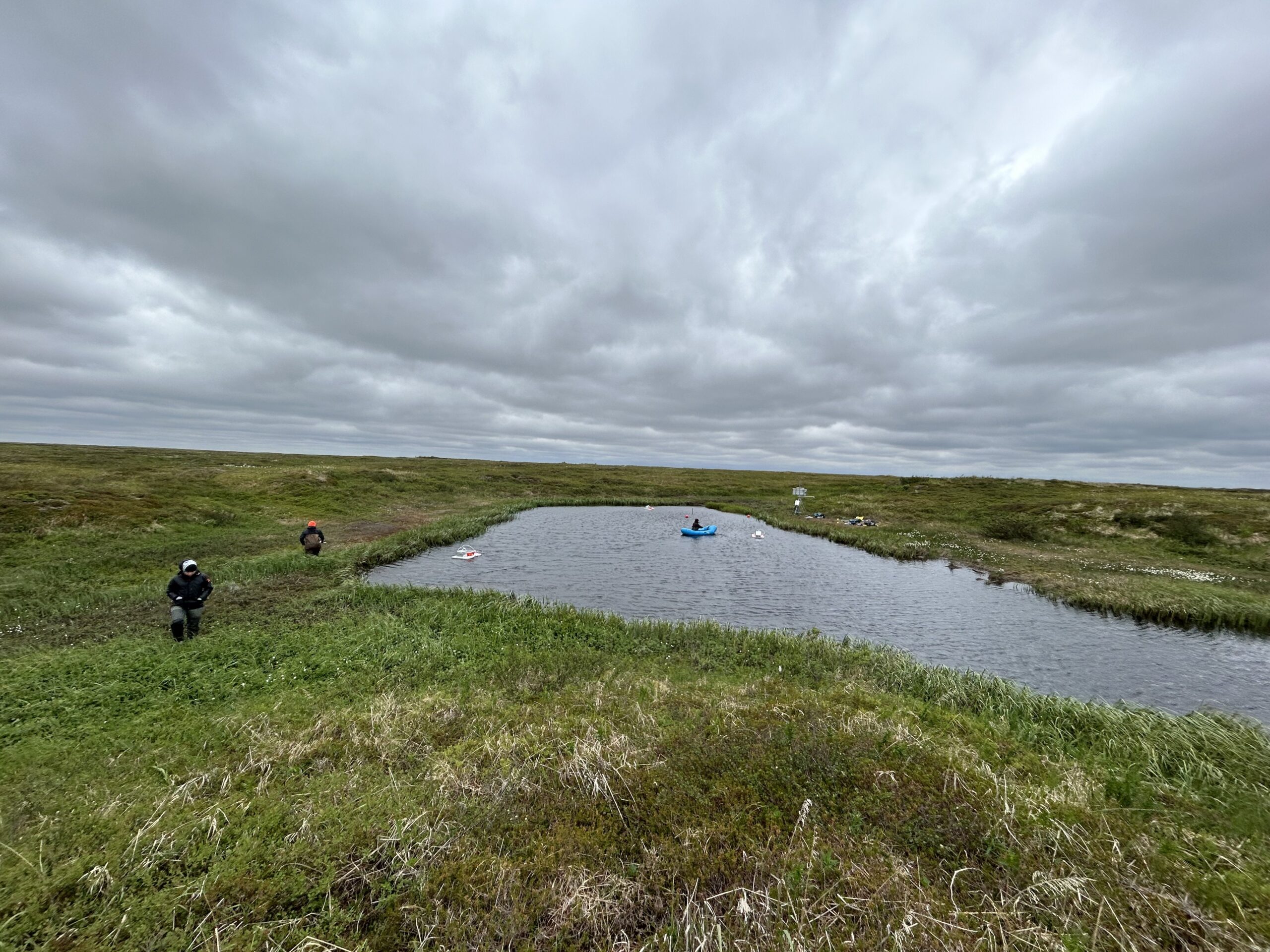
Two small lakes in the Yukon-Kuskokwim Delta where field data was collected and used to train the LAKE model.
Photos by Zoë Dietrich / Woodwell Climate Research Center
Lakes are home to specialized microbes that consume organic material in the water and on the lakebed, releasing it in the form of carbon dioxide and methane. Carbon carried into the lake from the surrounding ecosystem through groundwater and drainages can also be released as greenhouse gases.
The research team tested how shifts in temperature, incoming sunlight and energy, snow, and ice influenced the way carbon moved through the ecosystem by using an existing model called LAKE and key field data collected at two lakes in the Yukon-Kuskokwim Delta. The two lakes have one crucial difference—one is located in an area that experienced wildfire in 2015 and the other is unburned in recent history.
Both the model and the field data showed that shorter ice duration and higher water temperatures were associated with increased greenhouse gas emissions.
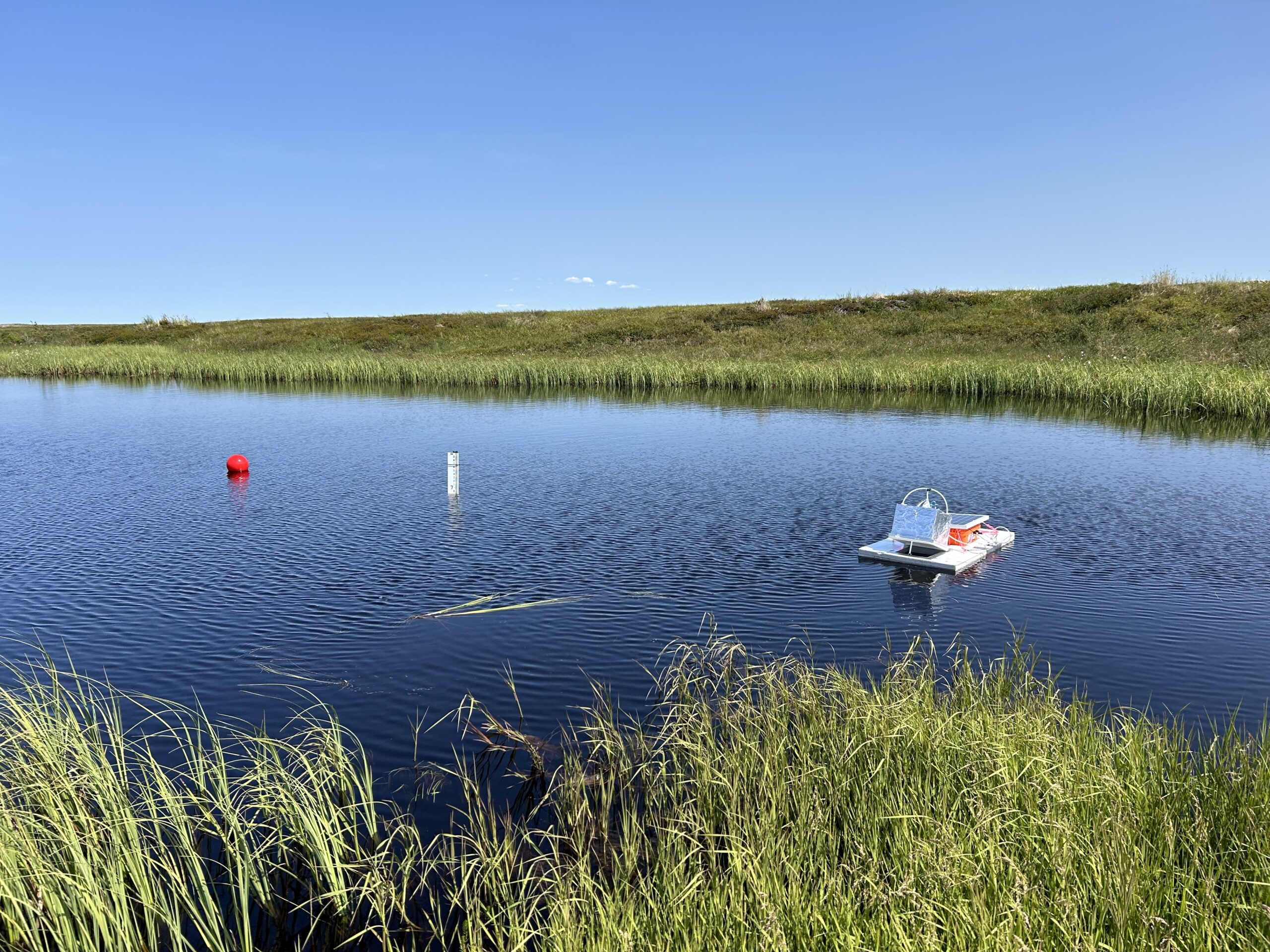
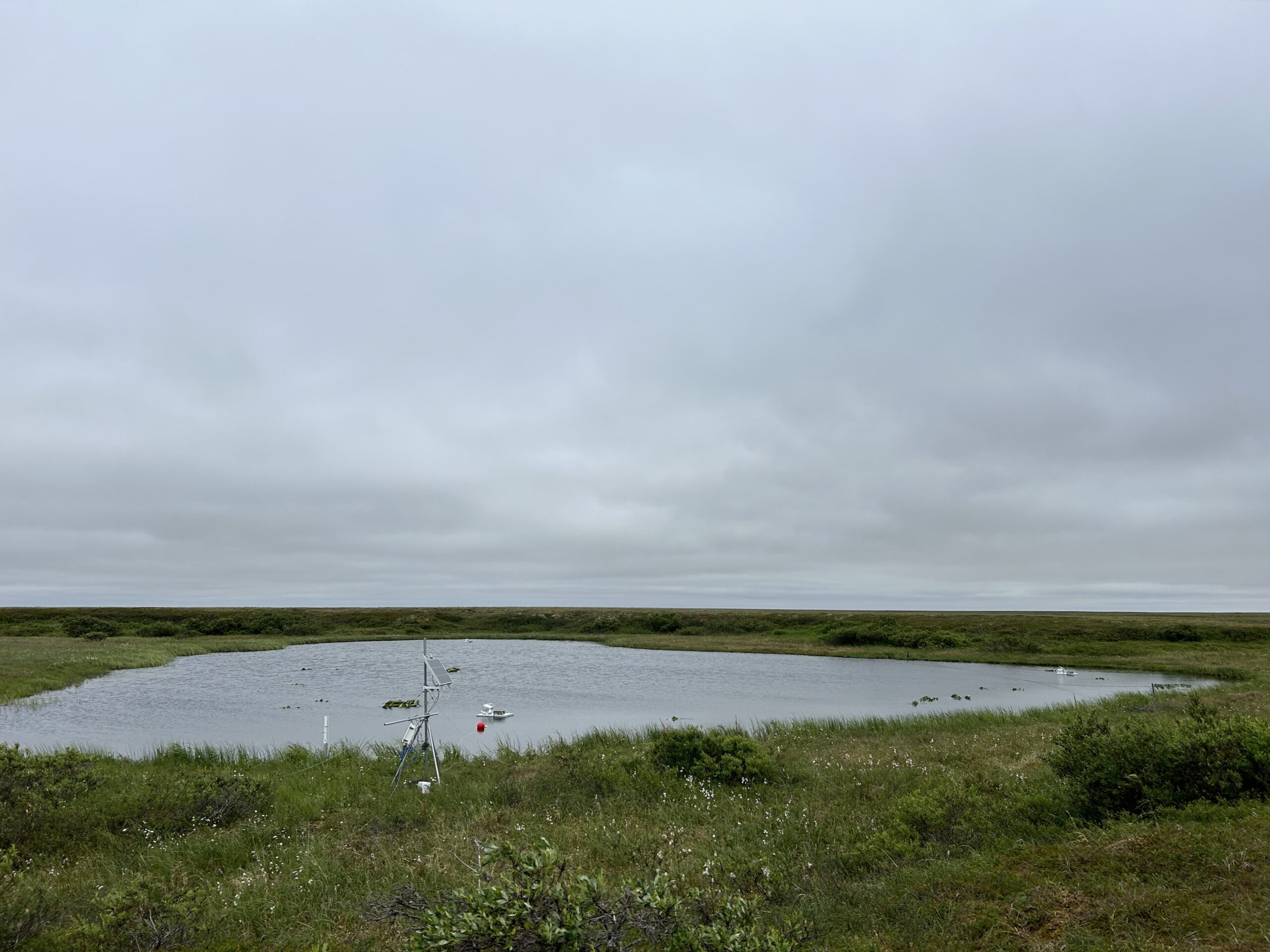
The lake that burned in 2015 and an autonomous floating chamber that monitors methane.
Photo by Zoë Dietrich / Woodwell Climate Research Center
“It’s encouraging that the model could reproduce the important biogeochemical signals our team measured in the field,” said Mullen. “The model also allows us to estimate carbon dioxide and methane emissions where we don’t have measurements, which will help us understand how an ecosystem in the permafrost region responds to further warming and change.”
The team found that small increases in air temperature can trigger substantial increases in methane and carbon dioxide fluxes from the lakes. And because the region is warming faster than the rest of the planet, this relationship could represent a meaningful surge in emissions by the end of the century.
“As the Arctic continues to warm faster than anywhere else on the planet, lakes and ponds will become increasingly important contributors to the global carbon budget,” said Senior Scientist Dr. Susan Natali, Permafrost Pathways project lead and co-author of the study. “This research helps us understand what we might expect—and what we need to prepare for.”
The study offers a scalable approach that blends field data with modeling to create a continuous time series of carbon fluxes from lakes and ponds across a watershed. In the future, the model’s outputs could be used to assess greenhouse gas emissions and uptake at regional to pan-Arctic scales.
But there’s more work to do to understand the complex processes and interactions that control how much carbon enters lakes—and where it comes from. “Calculating fluxes from lakes, rivers, and wetlands is challenging because water naturally flows downhill, causing lakes to collect biogeochemical signals from surrounding areas through groundwater,” explained Senior Research Scientist Dr. Elchin Jafarov, a study co-author.
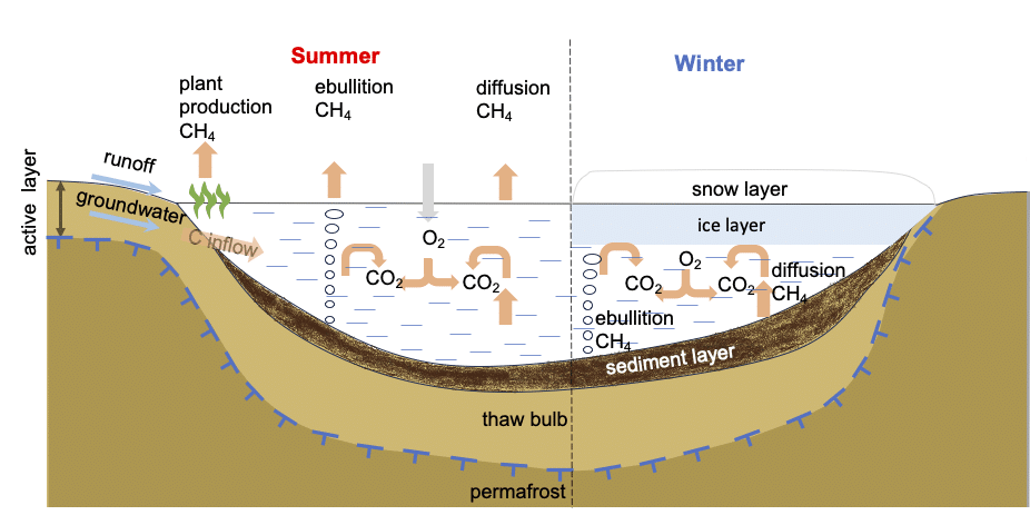
Above, the diagram illustrates carbon dynamics in a small Arctic lake during summer and winter seasons. During the summer, carbon enters the lake through groundwater flow. Methane then leaves the lake in three ways: it’s emitted by plants growing on top of the water, bubbled up from the sediment at the bottom, or diffused from the water’s surface. However, in the winter, a cap of ice on the lake’s surface prevents methane from escaping.
Diagram by Elchin Jafarov.
The model’s effective performance at two small lakes could also be used to address another perennial challenge of Arctic change research: the logistical challenges of collecting field data year-round in a remote region characterized by travel barriers and weather extremes.
“If we have questions we can’t observe or can’t fly to, we can address those questions using the model,” Jafarov said. Paired with low-cost autonomous carbon monitoring equipment, the LAKE model method could help scale aquatic insights across northern lakes and ponds.
And integrating field data from the paired lakes into the model offers a way for us to see into the future of a region experiencing profound changes due to permafrost thaw and more frequent and severe fires, explained Mullen. “Bringing the model and field data together really lets us explore before-and-after climate scenarios to learn more about the ways freshwater lakes, fire, and local processes interact in this rapidly-changing system.”
Go to top